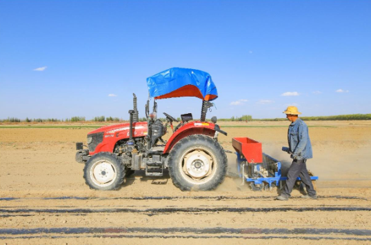
The picture shows farmers using GPS to locate tractors to lay mulch
On May 6, a mysterious machine drove past a large planting field in the Great Wall Village of the Xin Cheng town, where the open and flat tan land was naturally divided into long, neat ridges, and black mulch and drip irrigation belts were also covered on the ridges.
"This tractor is really not very good." The reporter praised the "driver" of the tractor's superb technology. Hearing praise, standing on the field to check the progress of film coating Jiayuguan grafted planting farmers professional cooperative chairman Yin Jun smiled mysteriously, "Don't worry, let you see its true face in a moment."
Ridge, laying film, drip irrigation belt, fertilization, in this ridge about 200 meters long, a series of operations took 3 minutes to complete. The tractor returned to the ground, waiting for the reporter to approach and see, can not help but be surprised, the cab was empty.
"Amazing, it's the function of a satellite." Yin Jun told reporters with a smile that before the use of navigation automatic driving system, ridges are the most laborious, all rely on the driver's eyes as a ruler to measure the direction to find distance, a day down the eyes staring pain, ridge effect is not good, "ridge back can not be straight, always bend, waste of land."
With navigation help, the driver frees his hands, which not only saves labor but also improves operation accuracy and land utilization.
At present, advanced equipment such as navigation and drones have become good helpers for farmers and improved planting efficiency. This year, the Xin Cheng town plans to plant an area of 67,000 mu of crops, of which 34,600 mu of grain crops are planned to be planted. During the spring plowing period, the town is expected to invest more than 1,500 sets of agricultural machinery of various types.
